Hurricane Ida 2021 Topographic Map 3D Render Color 照片檔
3D Render of the clouds of Hurricane Ida (Aug 28, 2021) on a Topographic Map of the Gulf of Mexico.
All source data is in the public domain.
Cloud texture: VIIRS, NOAA-20 courtesy of NASA.
https://worldview.earthdata.nasa.gov
Color texture: Made with Natural Earth.
http://www.naturalearthdata.com/downloads/10m-raster-data/10m-cross-blend-hypso/
Relief texture: SRTM data courtesy of NASA JPL (2020).
https://e4ftl01.cr.usgs.gov//DP133/SRTM/SRTMGL3.003/2000.02.11
Water texture: SRTM Water Body SWDB:
https://dds.cr.usgs.gov/srtm/version2_1/SWBD/

在 Photos.com 上購買這張圖片,更提供不同的相框選項。
購買授權
所有免版稅授權包含全球使用權限、全面的法律保障,定價簡單並享有計量折扣。
HK$2,250.00
HKD
Getty ImagesHurricane Ida 2021 Topographic Map 3d Render Color, 照片檔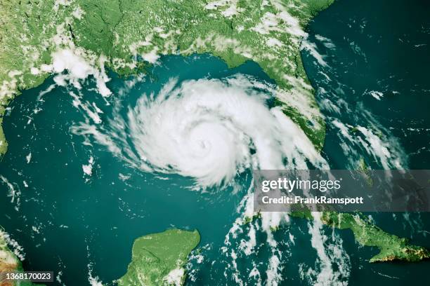 從 Getty Images 下載優越而真實的Hurricane Ida 2021 Topographic Map 3D Render Color照片檔。在我們廣泛多元的視覺內容目錄中,探索類似的高解像度照片檔。Product #:1368170023
從 Getty Images 下載優越而真實的Hurricane Ida 2021 Topographic Map 3D Render Color照片檔。在我們廣泛多元的視覺內容目錄中,探索類似的高解像度照片檔。Product #:1368170023HK$2,250HK$400
Getty Images
In stock詳情
創意 #:
1368170023
授權類型:
圖像集:
E+
最大檔案大小:
4800 x 3200 像素 (40.64 x 27.09 cm) - 300 dpi - 9 MB
上傳日期:
位置:
United States
發佈資訊:
已獲物業肖像許可授權