Tsunami evacuation area sign is viewed near Lapakahi State Historical Park on December 17 near Hawi on the Kohala Coast, Hawaii. Hawaii, the largest...海嘯
Satellite view shows Hurricane Lowell churning in the Central Pacific south of Hawaii’s Big Island, with a distinct eye and major hurricane strength....
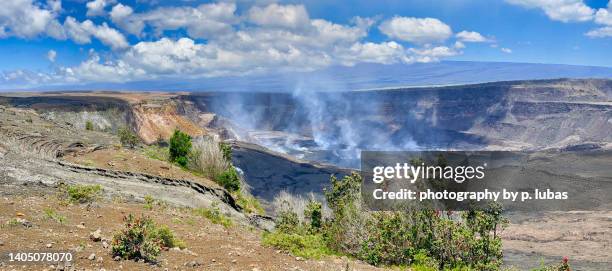
Visitors watch the eruption of the Kilauea volcano at the Devastation Trail overlook on March 11, 2025 in Volcano National Park, Hawaii. The eruption...火山, 爆發
hawaii red marked on usa map. detailed map with divided states including hawaii and alaska. vector - 夏威夷大島 幅插畫檔、美工圖案、卡通及圖標美國, 美國文化, 電腦圖形
antique image from british magazine: annexation of hawaii by usa, honolulu - 夏威夷大島 幅插畫檔、美工圖案、卡通及圖標19世紀風格, 三軍
razorback ridge line,scenic view of sea against sky,kahaluu,hawaii,united states,usa - 夏威夷大島 個照片及圖片檔風景 - 大自然
waipiʻo valley black sand beach at sunrise - panorama, big island, hawaii, usa - 夏威夷大島 個照片及圖片檔風景 - 大自然, 全景, 日出
Car is stuck partially submerged in floodwaters from Hurricane Lane rainfall on the Big Island on August 23, 2018 in Hilo, Hawaii. Hurricane Lane has...水災
Car is stuck partially submerged in floodwaters from Hurricane Lane rainfall on the Big Island on August 23, 2018 in Hilo, Hawaii. Hurricane Lane has...水災
Tsunami evacuation area sign is viewed near Lapakahi State Historical Park on December 17 near Hawi on the Kohala Coast, Hawaii. Hawaii, the largest...海嘯
The Ka'u Desert section of Hawaii Volcanoes National Park is seen closed due to high winds and heavy rainfall in Volcano Village, Hawaii, on August...
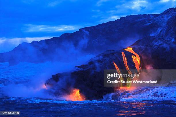
People watch as Hawaii's Kilauea Volcano erupts for the 21st time on May 11, 2025 in Kailua Kona, Hawaii.爆發, 夏威夷火山國家公園
antique black and white photograph: statue of kamehameha the great, honolulu, hawaii - 夏威夷大島 幅插畫檔、美工圖案、卡通及圖標檀香山, 舊的, 垂直構圖