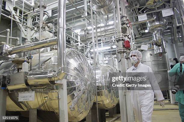
General view of the Natanz nuclear enrichment facility, is seen on April 9 180 miles south of Tehran, Iran. Iranian President Mahmoud Ahmadinejad...建築物, 伊朗
General view of the Natanz nuclear enrichment facility, is seen on April 9 180 miles south of Tehran, Iran. Iranian President Mahmoud Ahmadinejad...建築物, 伊朗
Maxar Satellite Imagery shows an updated overview of the Natanz enrichment facility after recent airstrikes. No new damage is visible, but...建築物, 衛星 - 太空旅行器
An Iranian nuclear power plant stands March 30, 2005 some 200 miles south of Tehran, in Natanz, Iran. The cities of Natanz and Isfahan in central...伊朗, 核能發電廠, 能源
Historical Maxar Satellite Imagery shows the Natanz nuclear facility before underground shielding was installed over the enrichment centrifuges....離心機, 建築物, 衛星 - 太空旅行器
Worker walks inside of an uranium conversion facility March 30, 2005 just outside the city of Isfahan, about 254 miles , south of capital Tehran,...伊朗, 建築物, 改變
Vantor satellite image shows concrete batch plant and central adits to underground tunnel complex near Natanz nuclear facility. Please use: Satellite...伊朗, 核能, 衛星 - 太空旅行器
In this satellite image, collected on May 8, 2006 the Uranium conversion plant in Isfahan, Iran is displayed. According to reports Iran is building a...核能發電廠, 伊朗
Vantor satellite image shows tunnel construction activity and road infrastructure near the Natanz nuclear facility in the mountainous area around...伊朗, 核能, 衛星 - 太空旅行器
Technicians work inside of a uranium conversion facility producing unit March 30, 2005 just outside the city of Isfahan, about 254 miles , south of...伊朗, 改變, 建築物
Maxar satellite imagery shows a post-strike overview of the Natanz nuclear facility. Visible disruptions in the terrain suggest underground impacts....伊朗, 建築物, 衛星 - 太空旅行器
Maxar satellite imagery shows multiple buildings destroyed at the Natanz enrichment facility following recent airstrikes. Analysis reveals...伊朗, 衛星 - 太空旅行器, 建築物
Vantor satellite image shows an overview of the Natanz fuel enrichment complex in Isfahan Province, Iran. Please use: Satellite image 2026 Vantor.伊朗
General view of the Natanz nuclear enrichment facility, is seen on April 9 180 miles south of Tehran, Iran. Iranian President Mahmoud Ahmadinejad...伊朗, 建築物
Maxar satellite image shows two large airstrike craters located directly over the underground centrifuge halls at the Natanz nuclear facility. These...伊朗, 建築物, 從衛星觀看
An Iranian nuclear power plant stands March 30, 2005 some 200 miles south of Tehran, in Natanz, Iran. The cities of Natanz and Isfahan in central...核能發電廠, 伊朗
Maxar satellite image shows a close-up of a large craterapproximately 5.5 meters in diametercreated by a recent airstrike above part of the...伊朗, 從衛星觀看, 衛星 - 太空旅行器
An overview of the construction area related to the future underground centrifuge assembly facility in the mountainous area south of the Natanz...伊朗, 衛星 - 太空旅行器, 建築業
Vantor satellite image shows a closer view of the Natanz nuclear facility complex and surrounding infrastructure in Isfahan Province, before the...伊朗, 核能, 從衛星觀看
Pre-strike satellite imagery of the Natanz nuclear enrichment facility, located approximately 135 miles southeast of Tehran. Please use: Satellite...伊朗, 建築物, 衛星 - 太空旅行器
Iranian flags fly along the highway on June 3, 2014 in Natanz, Iran. Iran is marking the 25th anniversary of the death of the Ayatollah Khomeini and...伊朗
Maxar satellite imagery shows an overview of the Natanz nuclear enrichment facility before the airstrikes. The facility appears calm and without...伊朗, 建築物, 衛星 - 太空旅行器
-- File picture dated April 3, 2007 shows an Iranian flag outside the building housing the reactor of the Bushehr nuclear power plant in the southern...伊朗, 核能發電廠, 核能
Iranian President Mahmoud Ahmadinejad visits the Natanz uranium enrichment facilities April 8, 2008 200 miles south of the Tehran, Iran. Ahmadinejad...伊朗, 財富, 探訪
Sits near an uranium conversion facility sits March 30, 2005 just outside the city of Isfahan, about 254 miles , south of capital Tehran, Iran. The...伊朗, 建築物, 改變
In this satellite image, collected on February 28 a uranium enrichment plant spreads over the land of Natanz in Iran. According to reports uranium...核能發電廠, 伊朗
Satellite image from Maxar shows an area of dirt directly above part of the underground Natanz nuclear complex, taken before recent airstrikes....伊朗, 從衛星觀看, 衛星 - 太空旅行器
An infographic titled "Nuclear facilities in Iran" created in Istanbul, Turkiye on June 13, 2025.伊朗, 核能
An unidentified International Atomic Energy Agency inspector disconnects the connections between the twin cascades for 20 percent uranium production...伊朗, 核能發電廠, 核能
Satellite imagery shows visible damage and disrupted facility infrastructure at the Natanz nuclear complex following reported June 2025 airstrikes....伊朗, 核能, 建築物
Vantor satellite image shows damage to a building at the Natanz nuclear facility showing structural impact and surrounding infrastructure. Please...伊朗, 核能, 從衛星觀看
Vantor satellite image shows ongoing tunnel construction activity near the Natanz nuclear facility and underground complex in Pickaxe Mountain....伊朗, 核能, 衛星 - 太空旅行器
Maxar imagery shows a close-up of several buildings destroyed by airstrikes at the Natanz enrichment facility. Please use: Satellite image 2025 Maxar...伊朗, 以色列, 衛星 - 太空旅行器
The inside of a uranium conversion facility producing unit is seen March 30, 2005 just outside the city of Isfahan, about 254 miles , south of...伊朗, 建築物, 改變
An Iranian nuclear power plant stands March 30, 2005 some 200 miles south of Tehran, in Natanz, Iran. The cities of Natanz and Isfahan in central...核能發電廠, 伊朗, 權威
Vantor satellite image shows tunnel construction activities and a large spoil pile near the Natanz nuclear complex at Pickaxe Mountain. Please use:...伊朗, 核能, 從衛星觀看
Vantor satellite image shows the Natanz nuclear facility under construction in 2002 showing buildings and infrastructure development. Please use:...伊朗, 核能, 建築業
Giant banner featuring symbolic images of the Natanz nuclear enrichment facility, Iranian nuclear scientists killed in Israeli attacks during the...伊朗, 離心機, 建築物
Historical Maxar satellite image shows the Natanz enrichment facility during early construction, prior to the burial of centrifuge buildings under...伊朗, 衛星 - 太空旅行器, 從衛星觀看
Maxar Satellite Imagery shows vehicle tracks and fresh dirt piles near the underground centrifuge buildings at Natanz. The activity suggests possible...衛星 - 太空旅行器
Vantor satellite image shows an overview of Natanz nuclear facility highlighting recent damage to a new building and surrounding infrastructure,...核能, 伊朗, 衛星 - 太空旅行器
Infographic with satellite image from Planet Labs PBC from June 22 showing visible damages from US strike on the Natanz uranium enrichment plant in...伊朗, 從衛星觀看
An overview of the construction area related to the future underground centrifuge assembly facility in the mountainous area south of the Natanz...伊朗, 離心機, 建築業
DigitalGlobe via Getty Images closeup imagery of the Natanz Fuel Enrichment Plant covering 100,000 square meters that is built 8 meters underground...從衛星觀看, 伊朗
Vantor satellite image shows construction activity at centrifuge buildings within the Natanz nuclear facility in Iran. Please use: Satellite image...伊朗, 建築物, 離心機
In this is satellite image the Heavy water plant of Arak, Iran is displayed. According to reports the existance of this plant came to light in...伊朗, 水生植物
Vantor satellite image shows the Natanz nuclear facility and its adjacent underground tunnel complex at Pickaxe Mountain in Iran. Please use:...伊朗, 核能, 衛星 - 太空旅行器
Vantor satellite image shows an overview of Natanz nuclear site and adjacent Pickaxe Mountain mining area in Isfahan Province. Please use: Satellite...伊朗, 衛星 - 太空旅行器, 從衛星觀看
Men work inside of an uranium conversion facility March 30, 2005 just outside the city of Isfahan, about 254 miles , south of capital Tehran, Iran....伊朗, 建築物, 改變
Worker stands inside of an uranium conversion facility March 30, 2005 just outside the city of Isfahan, about 254 miles , south of capital Tehran,...伊朗, 改變
The Natanz uranium enrichment facility buildings stand March 30, 2005 some 200 miles south of Tehran, in Natanz, Iran. The cities of Natanz and...伊朗, 財富, 建築物
Vantor satellite image shows the Natanz nuclear facility and adjacent underground tunnel complex in the mountainous area of Pickaxe Mountain. Please...伊朗, 核能, 衛星 - 太空旅行器
Giant banner featuring symbolic images of the Natanz nuclear enrichment facility, Iranian nuclear scientists killed in Israeli attacks during the...伊朗, 橫額, 建築物
Closer view of support infrastructure at the Natanz enrichment site before it was hit by airstrikes. Please use: Satellite image 2025 Maxar...伊朗, 以色列, 衛星 - 太空旅行器
The inside of a uranium conversion facility producing unit is seen March 30, 2005 just outside the city of Isfahan, about 254 miles , south of...伊朗, 建築物, 改變
Satellite imagery shows repair and reconstruction activity at the Natanz nuclear complex months after reported June 2025 airstrikes, including newly...伊朗, 核能, 建築物
Vantor satellite image shows the Natanz nuclear facility and underground complex in and around Pickaxe Mountain. Please use: Satellite image 2026...伊朗, 核能, 衛星 - 太空旅行器
Vantor satellite image shows an overview of the Natanz nuclear facility complex and surrounding desert terrain in Isfahan Province. Please use:...伊朗, 核能, 從衛星觀看