Map Of Alaska, Map Of Alaska, United States, Circa 1902, From The 10Th Edition Of Encyclopaedia Britannica.阿拉斯加州
In this photo provided by NASA, The eruption of the Cleveland Volcano is seen as photographed by an Expedition 13 crewmember on the International...阿拉斯加州
Maxar satellite overview imagery of the Tom Madsen Dutch Harbor Airport in Unalaska, Alaska. Please use: Satellite image 2022 Maxar Technologies.阿拉斯加州
Great Fox Island, a disappearing key near Crisfield, Md., is framed in the windows as Larry Laird, educator at Fox Island, navigates the 40-foot...
An aerial view of eroding marsh near The Lodge on October 30, 2019 in Fox Island, VA. Chesapeake Bay Foundation's Fox Island Environmental Education...
American Air force plane, crash landing in the Aleutian Islands. Illustration by Ogden Pleissner 1943.
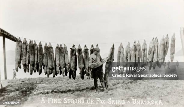
Fine string of fox skins, Unalaska, There is no official date for this image, taken c. 1890, United States, 1890.動物毛髮
Warships are anchored at Adak harbor in the Aleutian islands, while preparing to attack the Japanese base in Kiska, August 1943.第二次世界大戰, 美國
American Air force plane, crash landing in the Aleutian Islands. Illustration by Ogden Pleissner 1943.
Denver War Hero Honored Members of the Nuevo Mariachi de Tecalitlan, a mariachi band from Guadalajara, Mexico, performs at a ceremony honoring...
Denver War Hero Honored Members of the Nuevo Mariachi de Tecalitlon, a mariachi band from Guadalajara, Mexico, performs at a ceremony honoring Joseph...
War and Conflict, World War Two, Far East, pic: June 1943, American soldiers usinf a field piece against Japanese forces in the Attu Ridges, Aleutian...