establishing drone shot of luxury hotels and resorts in las vegas, nevada at night - 內華達州 個影片檔及 b 捲影像00:31
aerial view of dwight d. eisenhower hwy highway 80 and trout creek in elko county, wells, nevada, usa - 內華達州 個影片檔及 b 捲影像00:15
summer view of dwight d. eisenhower hwy highway 80 and truckee river in verdi, reno, nevada, usa - 內華達州 個影片檔及 b 捲影像00:20無人機角度
aerial view of dwight d. eisenhower hwy highway 80 and trout creek in elko county, wells, nevada, usa - 內華達州 個影片檔及 b 捲影像00:22
aerial view of dwight d. eisenhower hwy highway 80 and trout creek in elko county, wells, nevada, usa - 內華達州 個影片檔及 b 捲影像00:21
silhouettes of plant life in nevada desert with yellow haze of sunrise in distance. - 內華達州 個影片檔及 b 捲影像00:07
track forward along highway camera sharply rotates left to show pylons on roadside. - 內華達州 個影片檔及 b 捲影像00:17
track left over rocky terrain and ravines of desert surrounding lake mead nevada - 內華達州 個影片檔及 b 捲影像00:12
pan right across cracked earth and arid landscapes of including shrub silhouetted against blue sky nevada desert - 內華達州 個影片檔及 b 捲影像00:26美國
fast forward track down empty highway surrounded by barren landscape. las vegas. - 內華達州 個影片檔及 b 捲影像00:07開車
fast forward track along empty highway surrounded by barren landscape las vegas - 內華達州 個影片檔及 b 捲影像00:09
busloads of soldiers are brought onto the grounds of the nevada test site in 1952. troops to participate in shot dog of the tumbler snapper series. - 內華達州 個影片檔及 b 捲影像00:22美國
aerial: drone forward shot of pick-up truck moving in semi arid desert under cloudy sky on sunny day - ely, nevada - 內華達州 個影片檔及 b 捲影像00:16
rightward drone flight at night near suburban homes in henderson, nevada overlooking the strip in the distance - 內華達州 個影片檔及 b 捲影像00:26
ascending aerial establishing shot of henderson, nevada at sunset with the strip in the distance - 內華達州 個影片檔及 b 捲影像00:22
ms aerial td shot of farmland with green crops / fallon, nevada, united states - 內華達州 個影片檔及 b 捲影像00:26
ws aerial shot of farmland with green land and rocky mountains / fallon, nevada, united states - 內華達州 個影片檔及 b 捲影像00:16乾旱氣候
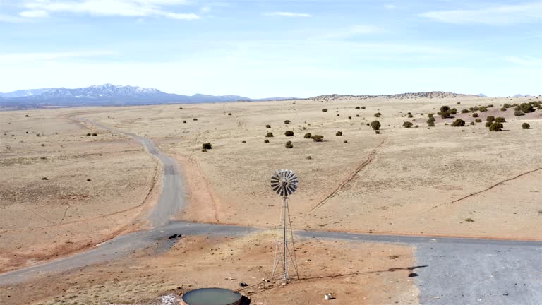
ms aerial tu shot of desolate desert in churchill county with no vegetation and strong sunlight / nevada, united states - 內華達州 個影片檔及 b 捲影像00:11
ms aerial shot of horses in pens with hay bales at indian lakes road facility / fallon, nevada, united states - 內華達州 個影片檔及 b 捲影像00:12
ms aerial shot of horses in pens with hay bales at indian lakes road facility / fallon, nevada, united states - 內華達州 個影片檔及 b 捲影像00:07
ms aerial zo shot of horses in pens at indian lakes road facility / fallon, nevada, united states - 內華達州 個影片檔及 b 捲影像00:31
ws aerial zi shot of horses in pens at indian lakes road facility / fallon, nevada, united states - 內華達州 個影片檔及 b 捲影像00:26
ws aerial view of desert land with dry earth and strong sunshine in churchill county / nevada, united states - 內華達州 個影片檔及 b 捲影像00:19
ms aerial shot of nevada state prison campus and buildings and surrounding barbed wire fence / carson city, nevada, united states - 內華達州 個影片檔及 b 捲影像00:19
ws aerial view of large red rock and valley of fire with rock formations during sunrise / nevada, united states - 內華達州 個影片檔及 b 捲影像00:27
united states the pilot and crew get ready to release the nuclear bomb at the testing site. the countdown begins. then, the explosion happens. people... - 內華達州 個影片檔及 b 捲影像01:15
ws zi mojave desert with mountain range and interstate 15 traffic through casino resort primm at nevada california state line / primm, nevada, usa - 內華達州 個影片檔及 b 捲影像00:15
death valley approaches global heat record; usa; california, heat, hot, heatwave, environment, temperature, trucks, lake mead, water, death valley,... - 內華達州 個影片檔及 b 捲影像03:51日落
thunderstorms can be seen in both of these clips, throughout the valley, summer weather, summer thunderstorms - 內華達州 個影片檔及 b 捲影像00:11
lockdown time lapse shot of vehicles on road near city against cloudy sky - las vegas, nevada - 內華達州 個影片檔及 b 捲影像00:08
droner aerial video of the ivanpah solar thermal power generation plant in the mojave desert. - 內華達州 個影片檔及 b 捲影像00:08
title "atom bomb - civil defense tests effect on typical town" superimposed over cloud from explosion / aerial pan desert test site with buildings... - 內華達州 個影片檔及 b 捲影像03:23爆炸
aerial drone view of a red convertible sports car on the road in red rock canyon national conservation area, nevada, united states of america, north america - 內華達州 個影片檔及 b 捲影像00:22日落, 無人機角度
hand held driving pov by shopping centers and small shops in desert town of pahrump nevada, a suburb of las vegas. "terrible's town casino" sign and american flag visible. - 內華達州 個影片檔及 b 捲影像00:42
hand held driving pov straight right through rural area in desert town of pahrump nevada near las vegas. lower class houses and mountains in bg. - 內華達州 個影片檔及 b 捲影像00:48
pan right to left of intersection of country roads near desert town or rural area. lower class houses and power lines near rundown lots. desert and mountain landscape in bg. - 內華達州 個影片檔及 b 捲影像00:33
hand held driving pov down main street of desert town of pahrump nevada. desert highway in nevada near las vegas. landscape with suburbs and housing developments in front of mountains in bg. various billboards and signs to side of road, along with americ - 內華達州 個影片檔及 b 捲影像00:51
wide angle of the clark county court house in las vegas. government buildings. - 內華達州 個影片檔及 b 捲影像00:14
aerial above the lithium pools of silver peak lithium mine in nevada, usa - 內華達州 個影片檔及 b 捲影像00:34美國, 錄影像
group of soldiers watching huge cloud of dirt and dust hanging in air from explosion / close shot of sign reading "us atomic energy commission,... - 內華達州 個影片檔及 b 捲影像02:47美國
panning shot of street; buildings, people on sidewalks, and lots of cars; signs "first national bank" "sahara" - 內華達州 個影片檔及 b 捲影像00:25