zoom in to bheri zone, nepal from earth. satellite view of the south asia. cinematic world map animation from outer space to territories. the concept of highlight the province, globe, tourism, travel, journey, aerial view of country - 地形學 個影片檔及 b 捲影像00:16地球, 大自然
zoom in to peru from earth. satellite view of the south america. cinematic world map animation from outer space to territories. the concept of highlight the country, globe, tourism, travel, journey, aerial view of countries - 地形學 個影片檔及 b 捲影像00:16地球
zoom in to zug, switzerland from earth. satellite view of the europe. cinematic world map animation from outer space to territories. the concept of highlight the province, globe, tourism, travel, journey, aerial view of country - 地形學 個影片檔及 b 捲影像00:16地球
zoom in to zürich, switzerland from earth. satellite view of the europe. cinematic world map animation from outer space to territories. the concept of highlight the province, globe, tourism, travel, journey, aerial view of country - 地形學 個影片檔及 b 捲影像00:16地球
zoom in to grisons, switzerland from earth. satellite view of the europe. cinematic world map animation from outer space to territories. the concept of highlight the province, globe, tourism, travel, journey, aerial view of country - 地形學 個影片檔及 b 捲影像00:16
zoom in to brazil from earth. satellite view of the south america. cinematic world map animation from outer space to territories. the concept of highlight the country, globe, tourism, travel, journey, aerial view of countries - 地形學 個影片檔及 b 捲影像00:16地球
zoom in to cupertino, california, united states from earth. satellite view of the western usa. cinematic world map animation from outer space to territories. the concept of highlight the cities, globe, tourism, travel, journey, aerial view of country - 地形學 個影片檔及 b 捲影像00:16
zoom in to san jose, california, united states from earth. satellite view of the western usa. cinematic world map animation from outer space to territories. the concept of highlight the cities, globe, tourism, travel, journey, aerial view of country - 地形學 個影片檔及 b 捲影像00:16
zoom in to napa, california, united states from earth. satellite view of the western usa. cinematic world map animation from outer space to territories. the concept of highlight the cities, globe, tourism, travel, journey, aerial view of country - 地形學 個影片檔及 b 捲影像00:16加州
surveyor measuring and checking blueprints on a building construction site. engineering and land surveying for express way development - 地形學 個影片檔及 b 捲影像00:13
male and female construction or civil engineering workers, wearing safety vest and helmets standing beside a tripod-mounted surveying instrument are inspecting blueprints at a construction site, infrastructure project - 地形學 個影片檔及 b 捲影像00:10
a vivid sunset glows in the western sky behind a dramatic escarpment, with a white gum tree silhouetted in the foreground - 地形學 個影片檔及 b 捲影像00:16大自然, 日落
zoom in to italy from world map and full detailing relief map, digital generated physycal map of the italy 4k stock video - 地形學 個影片檔及 b 捲影像00:15
4k aerial view of a picturesque golf course in victoria, australia – surrounded by natural beauty, suburban tranquility, and early morning calm - 地形學 個影片檔及 b 捲影像00:23
zoom in to iwate, japan from earth. satellite view of the east asia. cinematic world map animation from outer space to territories. the concept of highlight the province, globe, tourism, travel, journey, aerial view of country, - 地形學 個影片檔及 b 捲影像00:16
zoom in to granada, spain from earth. satellite view of the europe. cinematic world map animation from outer space to territories. the concept of highlight the province, globe, tourism, travel, journey, aerial view of country, - 地形學 個影片檔及 b 捲影像00:16
satellite view of america from space. cinematic earth rotation animation. concept of aerial view of countries, spinning globe, world map, tourism, travel, journey, - 地形學 個影片檔及 b 捲影像00:12地球, 星球
surveyor technician looks through a theodolite to level land for a wind turbine base in a power generation area. - 地形學 個影片檔及 b 捲影像00:26
[m] futuristic holographic terrain, 3d landscape topography, futuristic user interface - 地形學 個影片檔及 b 捲影像00:16
digital animation with smooth multicolored curved lines that imitate the movement of water. 3d rendering 4k - 地形學 個影片檔及 b 捲影像00:09
digital animation with curving colorful stripes that flow like waves on a calm sea. 3d rendering 4k - 地形學 個影片檔及 b 捲影像00:09噪音
malaysia map from space showing topography. world map showing malaysia geography. - 地形學 個影片檔及 b 捲影像00:08
endless flow of intricate wavy metallic glossy lines. digital seamless loop animation of a dark pattern with neon reflections. 3d rendering 4k - 地形學 個影片檔及 b 捲影像00:08
zoom in to hiroshima, japan from earth. satellite view of the east asia. cinematic world map animation from outer space to territories. the concept of globe, highlight, aerial view, tourism, travel, journey, cityscape - 地形學 個影片檔及 b 捲影像00:16地球
zoom in to west virginia, us from earth. satellite view of the united states of america. cinematic world map animation from outer space to territories. the concept of usa, highlight, globe, aerial view, tourism, travel, journey, cityscape - 地形學 個影片檔及 b 捲影像00:16美國, 外太空
zoom in to new york, us from earth. satellite view of the united states of america. cinematic world map animation from outer space to territories. the concept of usa, highlight, globe, aerial view, tourism, travel, journey, cityscape - 地形學 個影片檔及 b 捲影像00:16
zoom in to missouri, us from earth. satellite view of the united states of america. cinematic world map animation from outer space to territories. the concept of usa, highlight, globe, aerial view, tourism, travel, journey, cityscape - 地形學 個影片檔及 b 捲影像00:16美國
a young technician looks through a theodolite to level land for a wind turbine base in a power generation area. - 地形學 個影片檔及 b 捲影像00:19風力發電機
zoom in on monochrome map of united states - usa, 4k, high quality, dark theme, simple world map, monochrome style, night, highlighted country and cities, satellite and aerial view of provinces, state, city, - 地形學 個影片檔及 b 捲影像00:12美國
the language of maps- part 1 of 18. combines aerial photography with topographic models and several different kinds of maps to show that the language of maps is made up of symbols representing natural and man-made features of a given area of the earth's s - 地形學 個影片檔及 b 捲影像00:33
the language of maps- part 13 of 18. combines aerial photography with topographic models and several different kinds of maps to show that the language of maps is made up of symbols representing natural and man-made features of a given area of the earth's - 地形學 個影片檔及 b 捲影像00:31
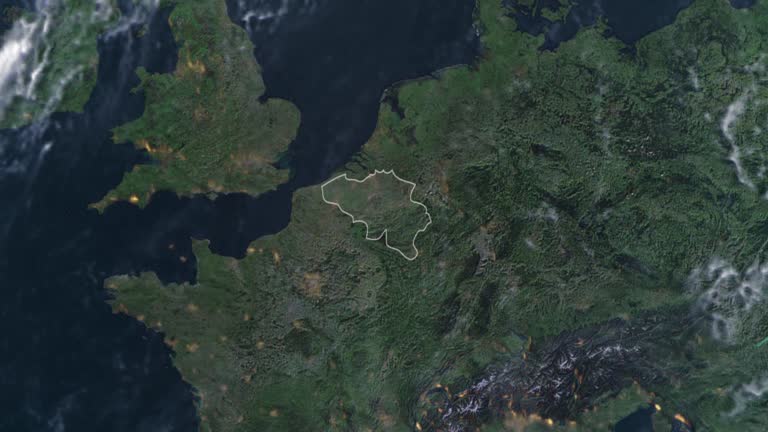
highlighted belgium map, zooming in from the space through a 4k photo real animated globe, with a panoramic view consisting of asia, africa and europe. epic spinning world animation, realistic planet earth, highlight, satellite, aerial - 地形學 個影片檔及 b 捲影像00:16星球
poland map with polish flag, zooming in from the space through a photo real animated globe, with a panoramic view consisting of asia, africa and europe. realistic 4k epic spinning world animation, planet earth half day and night rotating, - 地形學 個影片檔及 b 捲影像00:16
eastern europe map with russia, ukraine, belarus, moldova, romania, poland flag, zoom in to ukraine conflict terrain map from wide perspective view stock video - 地形學 個影片檔及 b 捲影像00:10
futuristic holographic terrain head up display, 3d landscape topography, futuristic user interface - 地形學 個影片檔及 b 捲影像00:30
futuristic holographic terrain head up display, 3d landscape topography, futuristic user interface - 地形學 個影片檔及 b 捲影像00:30
jidobawi rock (korean peninsula shaped rock) in heuksando island / sinan-gun, jeollanam-do, south korea - 地形學 個影片檔及 b 捲影像00:03
a 3-d map rotates on a computer monitor, and a gloved hand points to great hill in new york city. - 地形學 個影片檔及 b 捲影像00:19
drone footage discovering the beautiful dolomites mountains with meadows and alpine houses in alpe di siusi. - 地形學 個影片檔及 b 捲影像00:18