world map - highly detailed vector map of the world. dark vintage retro style. - 南極洲 幅插畫檔、美工圖案、卡通及圖標世界地圖, 地圖, 非洲 - 地理位置
antarctica maps for design. blank, white and black backgrounds - line icon - 南極洲 幅插畫檔、美工圖案、卡通及圖標地圖, 矢量圖
various floating icebergs. block of frozen ocean water. icy mountains with snow. melting ice peak. south and north pole. antarctic snowy landscape. - 南極洲 幅插畫檔、美工圖案、卡通及圖標冰山 - 冰的形態, 冰川, 矢量圖
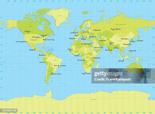
detailed world map divided into all seven continents - accurate & correct version - 南極洲 幅插畫檔、美工圖案、卡通及圖標世界地圖, 地圖
illustration of roald amundsen with men at camp polheim holding norwegian flag - 南極洲 幅插畫檔、美工圖案、卡通及圖標水彩畫, 挪威國旗, 南極
antique illustration: belgian south pole expedition return, ship "belgica" - 南極洲 幅插畫檔、美工圖案、卡通及圖標探險, 南極
political detailed world map - every country has own color - vector illustration scalable at any size - 南極洲 幅插畫檔、美工圖案、卡通及圖標世界地圖, 矢量圖, 地圖
world map - highly detailed vector map of the world. relief physical. - 南極洲 幅插畫檔、美工圖案、卡通及圖標世界地圖, 地圖, 國家 - 地域
a herd of woolly mammoths come down to drink from a lake during the pleistocene period - 南極洲 幅插畫檔、美工圖案、卡通及圖標古老的, 冰河時代, 史前時代